Yandex has developed a service for truck drivers
A new service from Yandex will simplify the parking process for truckers. Yandex has developed an excellent service for truck drivers, which became available on June 24.
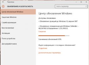
It works in conjunction with interactive resources "Yandex.Navigator" and "Yandex.Maps". This was reported in a statement by the press service of the Ministry of Transport of the Moscow Region. It is assumed that this service will allow drivers of large trucks to quickly plan their route, taking into account the location of nearby parking lots. He will also provide the driver with related information related directly to these parking lots.
This service operates within the framework of a daily ban on the entry of trucks into the Moscow Ring Road with a permitted maximum weight exceeding 12 tons. Owners of gadgets with operating systems Android and iOS will be able to use it.
The procedure for working with the service should not cause inconvenience, since the search process is quite simple. If the GPS module is enabled, the driver only needs to mobile device launch the Yandex.Navigator or Yandex.Maps application and enter the following "parking lots for heavy vehicles" in the search bar. The system will automatically determine the location of the car, after which the driver will be provided with visual information about all parking lots on the way. In particular, the driver will be able to see the location of the parking lot, phone number, address, number of common and free places, as well as a full list of services provided (service stations, gas stations, drivers' rest area, cafes). Recall that more than 80 parking lots were organized for temporary storage of freight vehicles in the Moscow region, and all of them are located near regional and federal highways. These parking lots are located on the roads: M-1 "Belarus", M-3 "Ukraine", M-6 "Caspian" and others adjacent to the city.
Restrictions, according to which freight transport cannot enter the Moscow Ring Road, have been in force since March 1, 2013. Only holders of special passes can enter the capital during the daytime, and these passes, in turn, can only be issued by the Ministry of Transport of the Moscow Region and only with the participation of the Center for Road Safety. We also recall that on October 1, 2013, the form of the entry pass to the Moscow Ring Road changed. Now they are issued only in electronic form.
To always easily find the right way in any city and in any place, most people use GPS navigator However, technology does not stand still: now you can have a convenient and fast navigator right in your smartphone. The Yandex service provides its users with free app“Yandex.Navigator”, which is designed to take you to any point in the city shortcut. The application is equipped with speakers, comments from other users, up-to-date data on traffic on the roads, traffic jams and repairs. Download for yourself this program and learn how to use it with the help of this article.
Downloading Yandex.Navigator and specifying the path
- You can easily download the Navigator from Yandex in the Play Market or the AppStore. Click "Install" after finding the app and wait a few seconds.
- Now sign in to the app. To find yourself on the map, you need to turn on location data on your phone. Open the tray of the device by swiping down on the screen with your finger, click on the “Geodata” icon and wait until it changes color.


- Now your current location will be instantly determined.
- Pay attention to the bottom panel in the program: all the necessary tools for working with the navigator are located here. The most important thing is finding a route. Try to pave your first path right now. Automatically your location is determined as point "A". Find your destination on the map and click on it.


- If you do not know where the place you are looking for is located, then just click on the “Search” icon. AT this menu you can either enter the address or name of the place, or search for it in the categories.


- As soon as the system determines the available list of places, click on the one you need.


- Now you see the possible options for point "B" on the map.


- Click on one of them, and then select the "Let's go!" field.

- That's all. The path is automatically set. If you have several route options, the time and kilometers for each of them will be indicated on top. The system will also notify you of traffic jams and repairs.

- Follow your path on the top bar. These tools will be very useful to you to quickly navigate the road.

How to add favorite places to Yandex.Navigator
To navigate in just a couple of seconds, you can add the most frequently visited places to a special list.
- Open "My Places".

- Here you will see handy bookmarks like "Home" and "Work". Add addresses or points on the map to them.
- In the “Recent” section, you have access to all the addresses that you have recently visited.


How to log in to Yandex.Navigator
Users authorized in the system can synchronize all settings on devices. This is very handy if you have multiple phones or if you suddenly get lost with a friend who has such an application.
- Press “Menu” again and then the “Login” button.


- The convenience of the system is that you can use not only account Yandex for authorization, but also any social network.
- As soon as you sign in and give the application access, authorization is complete.

How to set up Yandex.Navigator
The application has a user-friendly interface and many flexible settings. By selecting the “Settings” item in the menu, the following options become available:
- Map view from satellite or schematic.
- North location.


There are some minor points of interest:
- Announcer's voice. There's even Optimus Prime here.
- Setting up an appeal to Yandex by the command “Listen, Yandex”.
Customize the application to suit your needs and tastes.


Yandex.Navigator tools
The menu has a separate item "Tools". You should know why you need it.
Here you can mark your fines so that you always remember them, store your trip history, quickly find nearby car towing companies, commissioners. Don't forget to add penalties so that the app reminds you of them.


How to add a mark on the map in Yandex.Navigator
If you witnessed an accident or saw repair work on the road, you can notify other drivers about it.
- Click on the location on the map where the blockage occurred. Select the triangular road sign icon on the left.


- Now note what exactly happened on the road and select a lane if necessary. You can also just leave a comment on this place by clicking on the gray icon.
- So simply you can connect with other drivers right in your navigator.


13.03.2018
GPS navigator for trucks - which one to choose?
Navitel is one of the most popular
navigation programs in the Russian Federation
GPS navigator for trucks today - a popular and very common device. A GPS navigator in trucks is essentially necessary, truck routes often pass through unfamiliar terrain. It happens that there is no one around and there is no way to ask on the radio. In such a situation, truck GPS navigation and detailed truck maps are very, very useful. The choice of GPS navigators is currently huge. Forums have been studied, reviews and tests have been re-read, prices of various car navigators have been compared. And yet, which GPS navigator should a truck driver choose for use in a truck? The answer to this question is ambiguous, let's try to understand the criteria for choosing GPS for trucks. These are the screen size, the functional equipment of the device itself, the convenience of the navigation program and, of course, the relevance and detail of the maps themselves.
Let's dwell on them in more detail:
- GPS navigator screen size. Here you need to choose a compromise between the dimensions of the device and the required image detail. Again, it is necessary that the navigator mounted on the windshield does not unnecessarily block the driver's view. For use in trucks, we recommend GPS navigators with a screen of 5 inches or more. You also need to pay attention to the screen resolution, the higher it is, the more details you can see on it. We consider the resolution of 480x272 pixels sufficient.
- Functional equipment of the GPS navigator for trucks is not so significant. Of course, this does not mean that you should fundamentally abandon such things as Bluetooth, an FM transmitter, a video input for connecting a parking camera, a TV tuner. All these features can be useful both in a truck and in a car. For example, the presence of Bluetooth allows you to use a GPS navigator as a hands-free device for cell phone, as well as receive information about traffic jams. The FM transmitter allows you to output navigation program tips, music or movie soundtracks to the car radio receiver. Of course, a multifunctional GPS navigator cannot become a full-fledged replacement for a portable video player or TV, but it is quite capable of being on the hook.
Also pay attention to the volume random access memory navigator, it is recommended to purchase devices where the amount of RAM is 128 MB or more. The amount of built-in memory for storing the cards themselves and programs is also important. Today, the minimum required amount is 2 GB. But it is already worth looking at navigators with 4 GB of Flash memory on board. Installed version operating system not important for most users. anyway, all the work happens directly with the navigation program. The version of the installed navigation program is more important, but if we are talking about the NAVITEL system, then it is not critical. All versions of the NAVITEL program are very convenient and functional, and you can update the program at the same time as the maps. The update does not take much time, and the procedure itself is quite simple. - Convenience of the navigation program and the relevance of the maps used- is very important criterion in choosing a GPS navigator for a truck. The NAVITEL navigation system is very popular in Russia and in the CIS countries. The program itself is convenient and functional, updates of cartographic data are regularly released. NAVITEL maps are very detailed, even small buildings are present on them, house numbers are indicated. The maps even contain dirt roads and so-called. winter roads. First of all, we recommend the NAVITEL system, it also has the ability to lay cargo routes. There are corresponding options (settings) in the program. But, as in all other navigation programs, you will not be able to take advantage of this opportunity. To date, there are no cartographic data that would be brought together. THOSE. a program with truck routes may work, but up-to-date, comprehensive data on where there are traffic restrictions for trucks - today for Russia NO. And it does not matter which navigator to buy and which navigation program to use. Until map data specifically for cargo routes appears across Russia- the problem will not be solved. As soon as these data appear in nature at all and are available in the required form, they will appear in the NAVITEL system and in other systems too. In the meantime, it remains to use what is, and not to believe the rumors and tempting offers of various businessmen and firms, where they promise you loading cargo routes for Russia. Waste your money and time.
The use of the GLONASS system for civilian use, in our opinion, does not have any advantages over the GPS system. The quality of work is not better, GLONASS navigators themselves are more expensive today. The GLONASS system is Russian. But the vast majority of GLONASS navigators, as well as GPS navigators, are made in China. We did not find any fundamental advantages of GLONASS for the average consumer. If GPS navigators are not banned (which we would not like very much), we consider the use of GLONASS unjustified because of the price and small assortment (narrow model range).
GPS navigators can be purchased in our store in Chelyabinsk, as well as bought with delivery to the cities of Russia and Kazakhstan. RealRadio delivers walkie-talkies and radio equipment transport companies, as well as Russian post cash on delivery to cities:
Anapa, Arkhangelsk, Astrakhan, Barnaul, Belgorod, Belogorsk, Biysk, Birobidzhan, Blagoveshchensk, Bryansk, Veliky Novgorod, Vladimir, Volgograd, Volzhsk, Volzhsky, Vologda, Voronezh, Dimitrovgrad, Yekaterinburg, Ivanovo, Izhevsk, Yoshkar-Ola, Kazan, Kaluga , Kemerovo, Kirov, Kostroma, Krasnodar, Krasnoyarsk, Kurgan, Kursk, Lipetsk, Magadan, Magnitogorsk, Miass, Murmansk, Naberezhnye Chelny, Nizhny Novgorod, Nizhny Tagil, Nizhnevartovsk, Novy Urengoy, Novokuznetsk, Novorossiysk, Novosibirsk, Omsk, Orel, Orenburg , Orsk, Penza, Perm, Petrozavodsk, Podolsk, Pskov, Rostov-on-Don, Rybinsk, Ryazan, Samara, St. Petersburg, Saransk, Saratov, Smolensk, Sochi, Stavropol, Stary Oskol, Sterlitamak, Surgut, Syktyvkar, Taganrog, Tambov, Tver, Tolyatti, Tomsk, Tula, Tyumen, Ulyanovsk, Ussuriysk, Ufa, Cheboksary, Cherepovets, Chita, Mines, Engels, Yakutsk, Yuzhno-Sakhalinsk, Yaroslavl.
The list of cities to which GPS navigators are delivered is constantly updated.
We also deliver GPS navigators by the transport company Business Lines to the following cities: Abakan, Adler, Bratsk, Bugulma, Vladivostok, Volgodonsk, Dzerzhinsk, Zabaikalsk, Irkutsk, Novomoskovsk, Ulan-Ude, Ukhta, Khabarovsk.
To the cities of Armavir, Budennovsk, Nalchik, Nevinnomyssk, Neftekamsk, Nizhnekamsk, Pyatigorsk, Severodvinsk, Syzran - by the PEK company. To the cities of Berezniki, Nefteyugansk, Noyabrsk, Khanty-Mansiysk - by the Express-Auto company. To the cities of Almetyevsk, Achinsk, Ishimbay, Kiparisovo, Komsomolsk-on-Amur, Labytnangi, Neryungri, Petropavlovsk-Kamchatsky, Rubtsovsk, Ust-Ilimsk - by ZhelDorEkspeditsiya.
To the cities of Beloyarsky, Beloretsk, Verkhnyaya Salda, Glazov, Gubkinsky, Kamensk-Uralsky, Kachkanar, Korotchaevo, Krasnouralsk, Kungur, Kushva, Langepas, Nevyansk, Priobye, Rainbow, Salavat, Strezhevoy, Tuimazy, Uray, Mezhdurechensky, Nadym, Ozersk, Pionersky , Purovsk, Buzuluk, Pelym, Pokachi, Prokopyevsk, Purpe, Yugorsk, Seversk, Serov, Sibay, Solikamsk, Dry Log, Chaikovsky, Chusovoi, Oktyabrsky, Simferopol, Tobolsk, Ishim, Kogalym, Shadrinsk, Nyagan, Sarapul, Yuzhnouralsk - by KIT .
Delivery of GPS navigators is possible to any settlements by Russian Post cash on delivery or EMS Post, for example: Alapaevsk, Artyomovsky, Asbest, Astana, Aktobe, Aksu, Atyrau, Aksai, Almaty, Balkhash, Baikonur, Balakovo, Berezovsky, Bogdanovich, Verkhnyaya Pyshma, Zarechny , Ivdel, Irbit, Kamyshlov, Karpinsk, Karaganda, Kirovgrad, Kostanay, Kokshetau, Kyzylorda, Semey, Krasnoturinsk, Krasnoufimsk, Lesnoy, Nizhnyaya Salda, Nizhnyaya Tura, Novouralsk, Pervouralsk, Polevskoy, Revda, Severouralsk, Sysert, Clicker, Tavda, Vereshchagino , Nytva, Lysva, Krasnovishersk, Aleksandrovsk, Krasnokamsk, Ocher, Polazna, Chernushka, Gornozavodsk, Dobryanka, Gremyachinsk, Kudymkar, Gubakha, Yaiva, Vikulovo, Yarkovo, Nizhnyaya Tavda, Yalutorovsk, Kaskara, Kazanskoye, Borovsky, Petropavlosk, Romashevo, Golyshmanovo, Pavlodar, Tarmany, Taldykorgan, Zhezkazgan, Vinzili, Bolshoe Sorokino, Bogandinsky, Uporovo, Uralsk, Ust-Kamenogorsk, Shymkent, Taraz, Omutinskoye, Berdyugye, Abatskoye, Antipino, Isetskoye, Turtase, Norilsk, Salekha RD, Vorkuta, Votkinsk, Ekibastuz.
RealRadio Company keeps abreast of the latest in the field of radio communications and is pleased to offer the most modern means of communication for any task. Professional radio communication is our speciality!
Navigators for trucks differ, first of all, in software that takes into account the dimensions and weight of the vehicle when laying the route. Without such equipment, there is a huge risk of increasing the cost of extra mileage or becoming a traffic violation (in Europe, this is an expensive pleasure), and in the worst case, without calculating the dimensions of the truck, arrange a many-kilometer traffic jam, stuck in a narrow tunnel or under a bridge. Also, one should not forget to make an adjustment for the difference between domestic road realities and transport conditions in the rest of Europe.
The review below offers a rating of the best navigation systems for trucks. Models participating in it are selected based on technical parameters and reviews of truck drivers who used them in business.
TOP 5 best navigators for trucks
5 XGODY 740
Best price. Reliable reception of GPS satellites
Country: China
Average price: 4,500 rubles.
Rating (2019): 4.3
An excellent navigator for heavy vehicles, made of high quality material and has a special sun visor for better view information on the screen. The 7-inch touchscreen monitor gives you a large image that you don't need to look at, which does not distract from driving a truck. Confident operation and high accuracy of the received coordinates is provided by the 20-channel Sirf star IV GPS module. Preinstalled iGo software for navigation with latest updates maps of Europe and Russia.
Drivers note the convenience of working with the program, good detail and a sensitive screen. The reviews also positively assess the accuracy of determining the current coordinates, which allows demonstrating the location of the navigator with a minimum error. The available FM transmitter (allows you to tune in to the frequency of the radio) and a speakerphone will be useful on a long trip.
4 Pioneer 7009 Truck

Excellent system performance
The country: Japan (made in China)
Average price: 4 990 rubles.
Rating (2019): 4.5
The navigator is equipped with iGO Primo 9.6 software, designed to work with trucks. It is enough to enter the main parameters (dimensions and tonnage) so that when laying the route, the computer takes them into account when choosing the appropriate roads (in Europe this is of great importance). For a spacious truck cab, a 7-inch screen will be the best solution. In addition, the existing multimedia capabilities will allow you to watch videos downloaded to a micro SD card while relaxing.
In general, truck drivers involved in international traffic are satisfied with this model. The navigator will not lead them to the center of a transit city or to a low bridge (under which it is impossible to pass), but will lay out the best route, without insurmountable obstacles. Good feedback deserved the cost of the device, comparable to the navigation devices of a conventional car. The MStar Cortex A9 processor with a frequency of 800 MHz maintains a comfortable application speed without causing negative emotions from the owner.
3 NAVITEL A737

Better map detail
Country Russia
Average price: 5 990 rubles.
Rating (2019): 4.8
A high-tech device for compiling and controlling traffic along a given route using a GPS system. Designed for correct functioning with heavy vehicles, takes into account the mass and dimensions when calculating the trajectory. The processor with a frequency of 1 GHz and the same gigabytes of RAM ensure the flawless operation of the Navitel software. The 7-inch touchscreen monitor supports a screen resolution of 1024x600 pixels for clearer, richer images.
The owners deservedly consider this navigator to be the best solution for using trucks in the CIS - it has the most detailed road maps of the Commonwealth countries. The reviews also positively assess the correctness of the route construction, the small error of the current coordinates due to the excellent search and capture of signals from satellites (supports GPS and GLONASS). Android system 6.0, on which the device works, also allows you to use the navigator as a full-fledged tablet - there is a front and rear camera, Wi-Fi, GPRS support (for 2 SIM cards) and much more.
2 Garmin Dezl 770 LMT

Free map updates for Europe and current traffic conditions
Country: USA
Average price: 62,900 rubles.
Rating (2019): 5.0
A high position in our rating is occupied by a navigation system with a huge 7-inch screen and installed software adapted for trucks, which allows you to rationally draw up a route, taking into account the type, dimensions, weight of the vehicle and even the type of cargo. A feature of this model is unlimited free access to updates of maps of European countries and the current state of road traffic. It is possible to connect a rear view camera (type - BC30), synchronization with the owner's smartphone (supports the transfer of current location coordinates, parking places, can receive calls and much more).
The navigator allows you to calculate the estimated time of arrival at your destination, records the time spent on the road, has voice control, high speed route calculation. In the main menu there is a maintenance subsection, where it is very convenient to store information about the performed and upcoming maintenance work. Some reviews positively note the work of such a function as ALG (lane selection), the precise operation of the navigator saves fuel, time and makes the driver's work as easy as possible.
1 TomTom GO PROFESSIONAL 6200

The best guide on European roads
Country: Netherlands
Average price: 29,900 rubles.
Rating (2019): 5.0
This navigator is one of the best for organizing and planning freight traffic in Europe. The LIVE-service system, when an annual subscription is activated, allows you to update information about the location of radars in real time (there is also a built-in detector) and tracking cameras, learn in advance about traffic jams along the route, receive weather conditions, maintain correspondence with your dispatcher and much more.
My Drive not only maps traffic correctly, which is of great importance for a truck, but thanks to TomTom Traffic, it allows you to change direction in a timely manner, avoiding long delays on the road due to traffic jams. In their reviews, drivers note the high speed of the device - it not only quickly calculates the route, but also has the PhotoReal function, which clearly and in advance demonstrates which lane the truck should be in before the traffic junction. The free map updates throughout the life of the navigator are also highly appreciated by the owners.
Choosing a navigator for a truck is not an easy task. To this device there are much more specific requirements in comparison with devices that are placed on a passenger car. So, a navigator for trucks should have additional features so that the driver can easily get the desired route by entering the data. There are other nuances that are important to consider when buying a device.
What features should a navigator for trucks have?
A modern navigation device for a truck should allow you to set the following parameters:
- vehicle dimensions;
- maximum axle load;
- mode of movement;
- cargo weight;
- body capacity;
- load capacity;
- category of transported materials, taking into account the hazard class.
Based on the given parameters, the navigator determines the best route. In order for the device software to really determine the best route, you must remember to download maps in a timely manner. Obviously, most of the navigation devices cannot be used on trucks, as they do not have the necessary functionality. Many devices meet the requirements only partially and are therefore unsuitable for professional use. A driver who is trying to find a good navigator for a truck quickly realizes the seriousness and complexity of the task.

Screen and Active Lane Guidance
For the convenience of the driver of a heavy truck, a GPS navigator must have a sufficiently large display. It will provide convenient perception of information along the entire route of the machine. As practice shows, a screen of 7 "" will be enough.
How to choose a navigator for a truck that will provide the driver with maximum comfort when driving a vehicle? Professionals advise to pay attention to new models with advanced features. In recent years, models have begun to appear that have a unique ALG (Active Lane Guidance) function. Such devices are able to tell the driver which lane will be optimal for driving at the moment. When using the ALG function, the device screen is logically divided into 2 parts. When the software detects a curve, intersection or exit ahead, it displays the required lane in advance.
To make driving on international highways safer, you can connect a rear view camera to the navigator. It is purchased separately. To connect it, the device must have a video input.

Route planner
The navigator comes preloaded with maps. However, not all countries may be available by default. Therefore, it is worth worrying about the availability in advance desired card in your device. High-quality navigator for trucks allows the driver to easily set the route. The ability to specify multiple destinations at once should be supported. Software the device automatically suggests the best route.
Modern navigation devices for trucks support the Trip Planner function. It allows you to plan routes by specifying several points at once. The selected configuration can be saved for future trips. In the future, it can be loaded from the device's memory.
Update map data and traffic
If the above information still does not help clarify the question of which navigator is best for trucks, it is worth exploring others in more detail. useful features this class of devices. Perhaps their presence will be a decisive factor for someone to buy a particular model.

So, the navigator can be equipped with a built-in FM receiver that monitors traffic. This information will allow the driver to avoid traffic congestion in a timely manner. He will receive timely information about traffic jams and delays along the route caused by the repair of the route. More detailed information about the traffic situation, about alternative routes are called up with one touch on the screen. The traffic tracking service is available in Russia and in European countries. Not every navigator for trucks supports this feature. Therefore, its presence can be an unambiguous recommendation for the purchase of the device.
The mapping data must be updated regularly by the manufacturer. You just need to ensure that the device has access to the network. The procedure can be performed several times a year. It does not require a special subscription. In addition, map updates should be completely free of charge for as long as the device is in operation. Thanks to this function, the driver will always have the most up-to-date navigation data.
Providing data on service points for trucks
It is important that a truck navigator provides additional information that matters to professional drivers. The category of such information includes data that allows the driver to find out where is:
- a place to stop a freight vehicle;
- parking;
- filling station;
- hotel;
- weight station;
- point with Internet access;
- a car service that provides services for the maintenance and repair of heavy vehicles.

Logging and additional information
The information provided should be more than enough to deal with the question of which navigator for a truck is best suited. An additional benefit would be the device's support for IFTA reporting. In this case, the device automatically records data on the distance traveled, fuel consumed, hours of travel.
The navigator analyzes the time that the driver spends behind the wheel and automatically displays a warning about possible processing. Upon receipt of such a message, it is recommended to find the nearest parking lot on the map and take a break for at least 2-3 hours. A professional navigator for trucks is able to warn about the condition of the roadway, the height of the bridge, adverse weather conditions, sudden changes in terrain, and the branches of trees that are too low.